 By Muhammad Bilal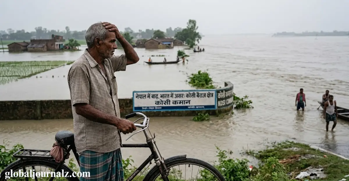
Nepal’s recent floods have raised a much bigger concern than the destruction left behind in the mountains. For India, the consequences could travel far beyond the border as rivers flowing through both countries respond to increasingly extreme weather.
The two neighbours are connected by a vast network of Himalayan rivers, making heavy rainfall and sudden flooding in Nepal a potential concern for communities downstream in India. But the impact is not always predictable or uniform.
In some cases, floodwaters can surge from steep mountain valleys with mud, boulders and debris, while in others the flow may weaken before reaching the Indian plains. What happens next depends on conditions on both sides of the border.
Rainfall in India, swollen rivers, embankments, drainage systems and rapid development can all determine whether rising water becomes a major disaster. This makes Nepal’s floods an important warning for India as the shared Himalayan river system faces growing climate and weather pressures.
Key Facts
- Nepal and India share major Himalayan rivers.
- Heavy rain in Nepal can raise flood risks downstream in India.
- Flash floods may carry mud, rocks and debris.
- Rainfall, embankments and drainage affect India’s flood impact.
- Extreme Himalayan weather is becoming a growing regional concern.
Table of Contents
How many Nepal rivers flow into India?
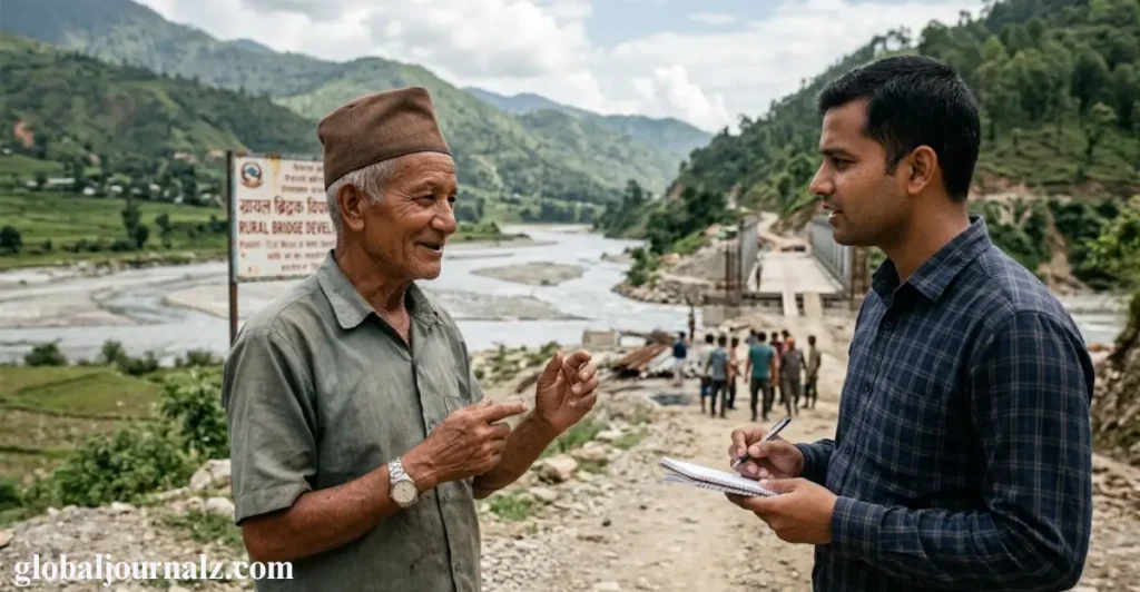
Nepal has more than 6,000 rivers and streams, most of which drain south into India and eventually connect with the Ganges. The major transboundary rivers include the Kosi, Gandaki, Karnali and Mahakali, which carry large volumes of water toward the Indian plains.
Around seven to nine major rivers flow from Nepal into India, while smaller rivers such as the Bagmati, Kamala, Rapti and Babai can also cause sudden flooding. Their steep, relatively small catchments mean heavy rainfall can quickly send large amounts of water downstream.
The Kosi, Gandak, Bagmati and Ghaghara are among the key rivers identified as important transboundary rivers. Their flow makes Nepal’s rainfall and flooding a major concern for downstream communities across northern India.
Which Indian states are most exposed?
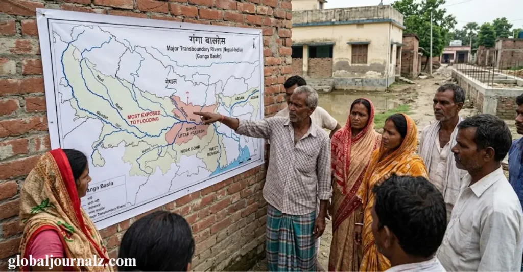
Bihar is India’s most exposed state, with roughly three-quarters of north Bihar officially classified as flood-prone. The Kosi, known as the “sorrow of Bihar,” is particularly notorious, while the Gandak, Bagmati and Kamala also contribute to repeated flooding.
The risk extends into Uttar Pradesh, where the Ghaghara, Rapti and Gandak affect districts such as Gorakhpur, Bahraich, Lakhimpur Kheri and Shravasti. Uttarakhand faces risks from the Mahakali-Sharda, while North Bengal can be affected by the Mechi and Mahananda.
Bihar carries the greatest overall burden, but Uttar Pradesh remains an important and sometimes overlooked part of the risk. When intense rainfall raises river levels in Nepal, downstream areas in India can face rapidly changing flood conditions, especially across low-lying communities.
When Nepal floods, what determines India’s fate?
The impact of a Nepal flood does not follow a simple border-to-border pattern. It begins with rainfall intensity and location, especially across the Siwaliks, Chure and Terai, where steep terrain and small catchments can quickly generate powerful flood peaks that move toward India.
- Rainfall intensity and location: Heavy rain in Nepal’s river catchments can rapidly increase the volume of water flowing toward India.
- River connections: Rivers such as the Narayani-Gandak carry water from Nepal into Bihar and Uttar Pradesh, making downstream areas particularly vulnerable.
- Water levels in India: The impact depends on existing river levels, rainfall, and conditions in India when the flood surge arrives.
- Embankments and drainage: The condition of embankments, blocked drainage, roads and settlements can determine how widely floodwater spreads across the plains.
- Early warnings and coordination: Timely river-flow data, alerts and cooperation between Nepal and India can give vulnerable communities more time to prepare and evacuate.
The next stage is shaped by the river system itself. Nepal’s rivers descend sharply at the mountain front, carrying large amounts of sediment before spreading across the plains through braided and shifting channels. Once the water reaches India, its effect depends on local rainfall, the level of the Ganges, embankments, barrages and drainage conditions.
This means Nepal largely influences the peak flow at the border, while India’s own conditions can determine how severe the flooding becomes. The 2008 Kosi disaster demonstrated this clearly, as an embankment failure caused catastrophic flooding even though the river was carrying far less water than its designed capacity.
How Nepal’s rain becomes India’s flood risk
The 2008 Kosi disaster remains one of the clearest examples of how rainfall, rivers and infrastructure can combine to create a major flood emergency. Nearly 400 people died in Bihar after the Kosi breached an embankment, sending water into areas that had experienced little or no flooding for decades.
What made the event especially significant was that the river’s flow was reportedly only around a tenth of its carrying capacity. The disaster was instead linked to a weakened and poorly maintained embankment, showing that extreme flooding does not always require an exceptionally large river discharge.
Years of erosion and inadequate maintenance had created vulnerable points along the structure before the breach occurred. The episode highlights why India’s flood risk depends not only on Nepal’s rainfall and river levels but also on the strength of flood-control infrastructure and the condition of the surrounding floodplain.
How much warning can India get from Nepal?
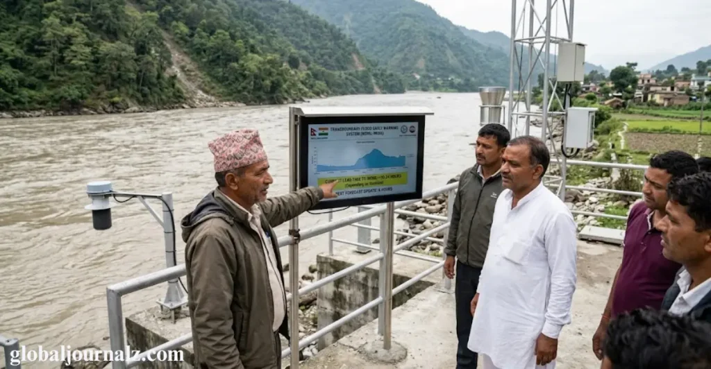
India can have anywhere from a few hours to two days of warning before floodwater from Nepal reaches vulnerable areas, depending on the river and how quickly water moves downstream. The Kosi and Gandak can reach the Bihar plains in about a day, while the Ghaghara generally takes longer.
Nepal and India already share real-time rainfall and river-level data through monitoring stations, helping India’s Central Water Commission issue flood forecasts. However, gaps remain in fast-flowing Chure catchments, shared forecasting models and regular information about embankments, sediment and changing river channels.
The most difficult part is the last mile, where an official warning must reach people living in danger zones. Better early-warning systems, continuous glacial lake monitoring and faster cross-border data sharing could provide communities with crucial extra time to evacuate.
What is the biggest misconception around Nepal and floods in India?
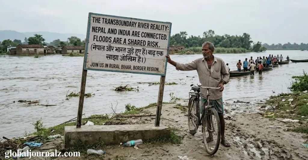
A common misconception is that Nepal deliberately “releases” water into India during major floods. Nepal has limited large-scale storage capacity, while the Kosi and Gandak barrages are operated by India, meaning flooding across the border is primarily linked to upstream rainfall rather than gates being opened in Nepal.
- Nepal does not simply “open the gates” Flooding is mainly driven by rainfall, river flows and sudden natural events.
- Rainfall in Nepal matters greatly Heavy upstream rain can rapidly increase water flowing toward Bihar and Uttar Pradesh.
- India also shapes the outcome River levels, embankments, drainage and sediment conditions can determine how severe flooding becomes.
- Floods are a shared river-basin problem Nepal is upstream while India is downstream, so events in one country can quickly affect the other.
- Cooperation matters more than blame Better real-time data, forecasting and early-warning systems can help both countries reduce flood risks.
Nepal’s rainfall still matters enormously because much of the water reaching north Bihar and eastern Uttar Pradesh falls upstream in Nepal. The country supplies around 40% of the Ganges’ average annual flow, making its hydrology particularly important for India’s flood and water management.
Flooding is therefore shaped by conditions on both sides of the border rather than one country’s actions alone. Indian rainfall river levels embankment integrity, drainage and sediment can determine how severe the impact becomes, while Indian barrages and embankments can also contribute to backwater flooding in Nepal’s Terai.
So what should worry India the most?
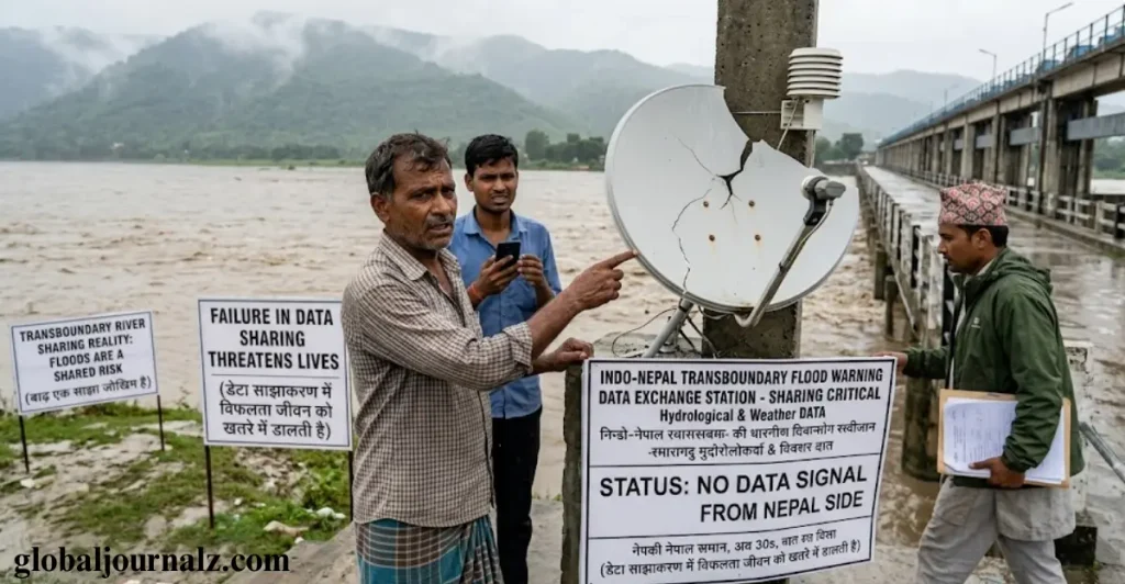
India’s biggest concern may be fast-moving Himalayan hazards rather than ordinary river floods. Intense rainfall, melting ice, unstable slopes and huge amounts of sediment and debris can combine to produce destructive flows that give communities very little time to react.
The Chamoli disaster in 2021 and the Dharali disaster in 2025 demonstrated how quickly Himalayan events can escalate. Water mixed with rock, debris and sediment can become a powerful flow capable of destroying roads, villages, bridges and hydropower infrastructure within a short period.
Climate change adds another layer of uncertainty by affecting rainfall patterns, glaciers and high-mountain stability. India therefore needs stronger continuous monitoring, faster hazard detection and reliable early-warning systems across the Himalayan region to identify dangerous events before they become disasters.
Conclusion
Nepal’s floods are not just a problem for communities north of the border because their effects can quickly travel into India. Shared Himalayan rivers mean heavy rainfall, flash floods and rising water levels in Nepal can create serious risks downstream. But the severity of flooding in India also depends on rainfall, embankments, drainage and river conditions within the country. This makes cross-border cooperation essential for sharing data, improving forecasts and delivering warnings faster. India also needs to prepare for sudden Himalayan hazards that may leave communities with very little time to respond. As extreme weather becomes more difficult to predict, stronger monitoring and better flood preparedness will become increasingly important. Ultimately, reducing flood damage will require Nepal and India to treat their shared rivers as a common regional challenge rather than a source of blame.
Why are Nepal floods a concern for India?
Nepal and India share several major Himalayan rivers, so heavy rainfall and flooding in Nepal can increase water levels downstream. Bihar, Uttar Pradesh and other northern areas can face higher flood risks when these rivers rise quickly.
Which Indian states are most affected by floods from Nepal?
Bihar faces the greatest risk because several major rivers from Nepal flow through or into the state. Uttar Pradesh, Uttarakhand and parts of West Bengal can also be affected by rising rivers and sudden flooding from upstream areas.
How quickly can floodwater from Nepal reach India?
Depending on the river, floodwater can reach vulnerable areas in India within a few hours to around two days. The Kosi and Gandak can reach the Bihar plains relatively quickly, while other rivers may take longer.
Does Nepal release floodwater into India?
Flooding is mainly caused by heavy rainfall, natural river flows and local conditions rather than Nepal simply releasing water into India. River levels, embankments, drainage and barrages in India can also influence how severe the flooding becomes.
How can India reduce the risk from Nepal floods?
Better cross-border data sharing, faster flood forecasting and stronger early-warning systems can give communities more time to prepare. Maintaining embankments, improving drainage and monitoring Himalayan hazards can also reduce potential damage.
 admin
admin